|
|
| METHODS OF INFORMATION ACQUISITION FOR PLANNING
(MEASUREMENTS, WIND TUNNELS, NUMERICAL MODELLING) |  |
| | | |
 4.3.6 The Micro-Scale Model MISKAM 4.3.6 The Micro-Scale Model MISKAM |
MISKAM (EICHHORN, 1996; VDI 3782 Page 8) is one of the most sophisticated microscale models. It is a three-dimensional flow and dispersion model for the small-scale prognosis of wind distribution and immission concentrations from the level of roads up to whole city districts. MISKAM allows for the explicit handling of buildings and even dense roadside development so that characteristic air flows in the vicinity of buildings can be simulated. Pollutant sources as point or line sources can be randomly distributed within the model area.
MISKAM is used for small-scale processes with an extension of up to several hundred metres and therefore qualifies particularly for road and urban planning. A corresponding Windows version WinMISKAM is also available. Figure 4/25 to Figure 4/28 give calculation examples.
Figure 4/25 depicts the flow field at the prevailing wind direction (southwest). The wind blows in the longitudinal direction of the roads, which causes only light canalisation effects and clearly illustrates the building"s impact.
Figure 4/26 shows the underlying building model and Figure 4/27 the nitrogen oxide immissions calculated on the basis of the local wind statistics, i.e. that the flow fields at different inflow conditions as well as their weighting according to their frequency of occurrence are included.
Figure 4/28 was created by means of a GIS (geographic information system) through the intersection of two MISKAM result files (reference case – planning case).
|
|
| | | |
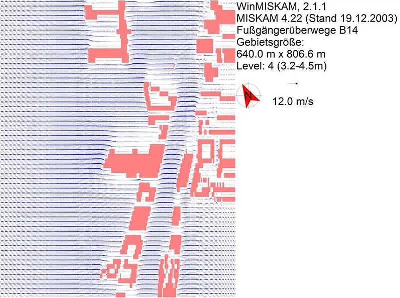 |
| Fig. 4/25: WinMISKAM, Flow field at Southwest flow (detail) | | |
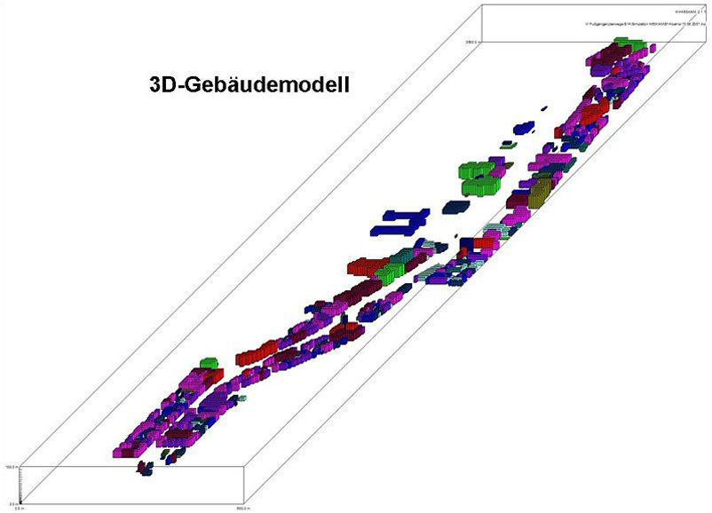 |
| Fig. 4/26: Building modeling in WinMISKAM | | |
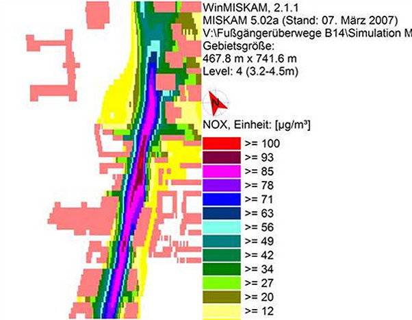 |
Fig. 4/27: WinMISKAM, Immission
calculation | | |
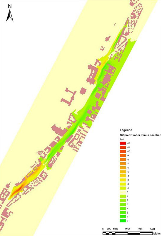 |
| Fig. 4/28: Zero case plan case comparison in GIS |
|


