|
|
| METHODS OF INFORMATION ACQUISITION FOR PLANNING
(MEASUREMENTS, WIND TUNNELS, NUMERICAL MODELLING) |  |
| | | |
 4.3.4 The Model MLuS-02 for Calculating Pollutant Dispersal 4.3.4 The Model MLuS-02 for Calculating Pollutant Dispersal
on Roads Without Dense Peripheral Development |
The model MLuS-02 (Merkblatt ³ber Luftverunreinigungen an Strassen ¢ Handbook for Air Pollution on Roads; Version 6.0 Edition 2005) was produced by the Research Institute for Roads and Traffic in Cologne. The model allows the estimation of average annual pollution and short-term pollution (98-percentile) produced by traffic. In the "General Road Building Memorandum No. 30/1992" the Federal Minister for Transportation recommended the model"s use for federal highways. In its Administrative Regulations (GABL 2002, No. 14, p.817) the Transportation Ministry of Baden-W³rttemberg also signed on to this decree. Accordingly, the MLuS-02 is to be used for federal highways, state roads, and municipal connecting roads.The MLuS-02 allows the numerical estimation of airborne gas pollution on roads without or with loose peripheral development (Figure 4/22).
The model is not valid for the calculation of pollution in street canyons or in the middle of dense development. Likewise the model is not supposed to be used on strongly differentiated terrain.
Since the model only deals with calculated estimates of air pollution on roads, cases with special values (e.g. exceeding the threshold values) require a detailed specialized appraisal.
The bases for the computations are the distance-dependent concentration ratios depicted in
Figure 4/23.
MLuS-02 (Edition 2005) can be used for:
Traffic counts above 5,000 vehicles/day
Velocities above 50 km/h
Trough depths and dam heights under 15 m
Lengthwise street inclination less than 6%
Two or more lanes
Gaps within the frontage development > 50%
Distances between the buildings and the edge of the lane > 2 building heights
Building width < 2 building heights
Distances from the road up to 200 m
With the decrease in concentrations as distance increases, it is apparent that these decreases are less pronounced for nitrogen dioxide and hydrocarbons relative to other pollutant components. In the case of NO2 this can be traced back to the special air chemistry involved in the conversion of NO to NO2.Furthermore now also the computation of the influence of noise protection walls and barriers as well as of tunnel portals and crossings is possible.
|
|
| | | |
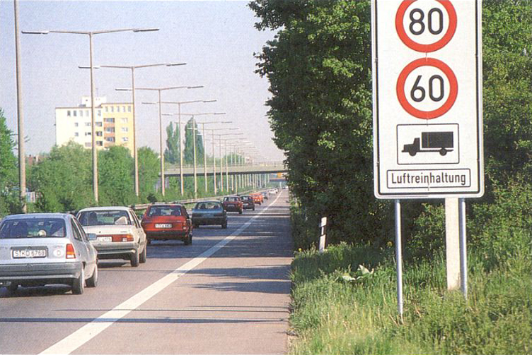 |
| Fig. 4/22: The road (and its automobile traffic) as (linear) source of pollution | | |
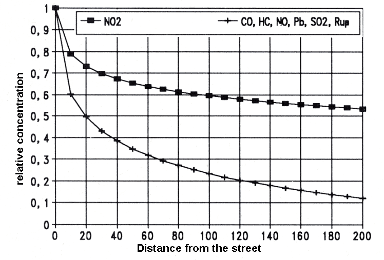 |
| Fig. 4/23: Relative dispersal of various pollutants according to MLuS-92 |
|


