|
|
| METHODS OF INFORMATION ACQUISITION FOR PLANNING
(MEASUREMENTS, WIND TUNNELS, NUMERICAL MODELLING) |  |
| | | |
 4.3.2 The Cold-Air Flow Model KALM and KLAM 21 4.3.2 The Cold-Air Flow Model KALM and KLAM 21 |
The model KALM (SCHAEDLER, LOHMEYER 1996) is a cold-air flow model. It calculates the time-elapsed progression of cold air flows when provided with temporally-constant cold-air production rates. The horizontal wind velocity and the volume of cold-air flow are calculated along with the density of the cold air layer.
Through the coupling of wind fields calculated by KALM with dispersal models, e.g. LASAT (JANICKE, 1996; VDI guidline 3945 page 3, 2000), pollutant dispersal in cold-air flows can also be calculated.
Figure 4/19 shows examples of the KALM model for the flow-density volume of cold air in the city area of Stuttgart.
The cold air flow-density volume is the amount of cold air in mł that flows per second through a 1-m wide strip spanning the vertical distance between the earth"s surface and the top boundary of the cold air layer. Its unit is mł/ms. In pronounced cold-air systems, the runoff amount to several million cubic meters per hour, with thicknesses up to several decametres. Higher-lying areas and the upper sections of valleys are known as primary sources of cold-air production, while the middle and lower sections of valleys as well as low-lying areas are cold-air collection and blockage areas. Since the latter areas are often densely settled, they can exert a "cold-air negating" effect via the warming and flow obstruction associated with their structures.
The German Meteorological Service (DWD) also offers a cold-air discharge model (KLAM 21). KLAM 21 is a two-dimensional mathematico-physical simulation model for the calculation of cold-air flows and accumulations in orographically structured terrain. It has proven itself in numerous official expert opinions on urban, regional and federal planning issues (www.dwd.de).
Figure 4/20 and Figure 4/21 show a sample calculation.
|
|
| | | |
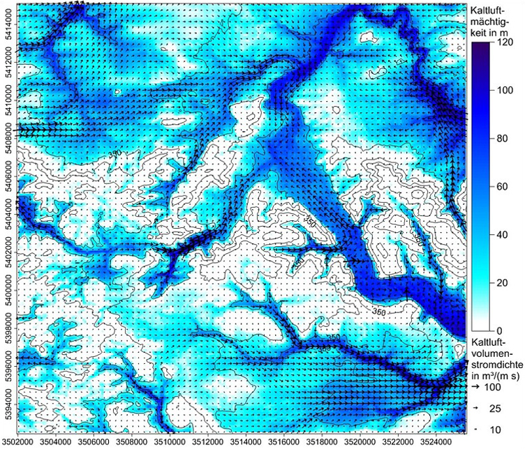 |
| Fig. 4/19: Cold air speed and cold air flow-density volume in Stuttgart, computed with KALM (SCHAEDLER, LOHMEYER, 1996) | | |
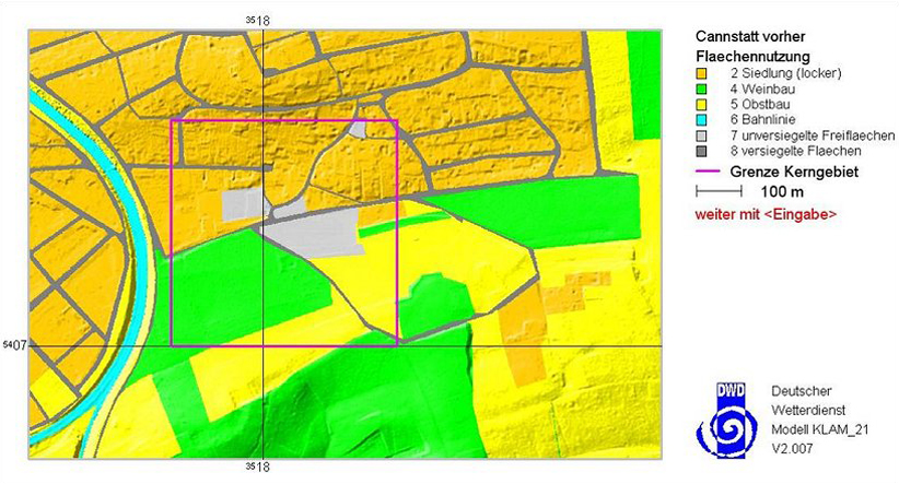 |
Fig. 4/20: Land use and terrain in KLAM 21,
Source: Office for Environmental Protection of the City of Stuttgart | | |
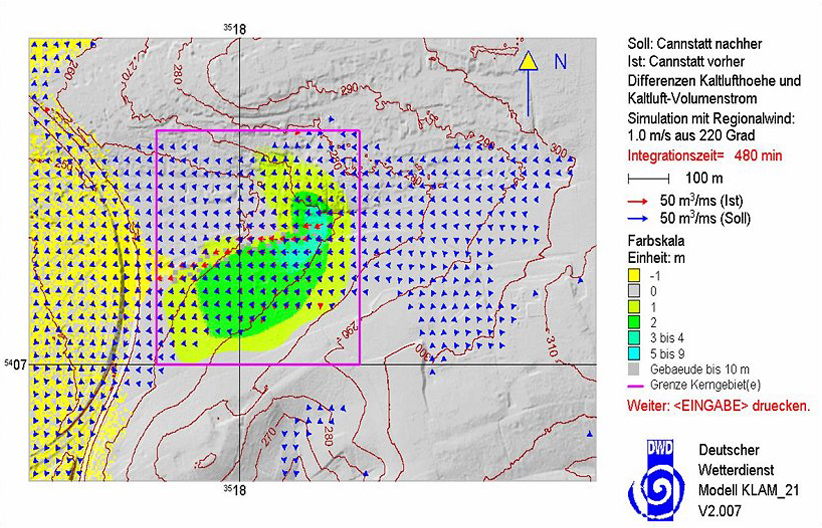 |
| Fig. 4/21: Height differences cold air and cold air flow in KLAM 21, Source: Office for Environmental Protection of the City of Stuttgart |
|


