|
|
| METHODS OF INFORMATION ACQUISITION FOR PLANNING
(MEASUREMENTS, WIND TUNNELS, NUMERICAL MODELLING) |  |
| | | |
 4.1.2 Measurements with mobile measurement devices 4.1.2 Measurements with mobile measurement devices |
In order to account for the high spatial and temporal variation of urban climatic parameters, additional ambulatory measurements can be helpful. They can be carried out from the air, in a vehicle, on a bike or afoot. The equipment of integrated climate and air measurement vehicles is similar to that of measuring stations, i.e. that they simultaneously collect all major meteorological variables and air pollutants (Fig. 4/3). Remoter and more isolated places may require an all-terrain vehicle. Navigation systems help to reach pre-defined measuring points most accurately.
Depending on the assigned task, measurement periods at one place can vary significantly. It is essential to consider at least the time needed to set the individual measurement devices and to exclude interferences from one"s own vehicle. For a representative local sampling, other requirements might need to be considered. Simultaneous measurements at different places demand several measuring vehicles; otherwise (e.g. for grid measurements) one vehicle is sufficient. The temporal representativeness necessary for a comparison can be achieved in the long run by varying the starting times and starting points so that, in the course of one year, the same measuring point is served for example at different times of the day, of the week and of the year. It is advisable, however, to synchronise the data with a continuously collecting measuring station within the area under investigation.
Figure 4/4 shows the result of temperature measurement sequences in the area of a large city park and its surroundings in Stuttgart (KNAPP, 1998). One can recognize the lower air temperatures in the park and its immediate vicinity. A deep penetration of cool air is only visible where the relief supports a cold air flow.
Location-based data can also be obtained through remote sensing procedures (e.g. IR thermal scans) from aircraft or satellites. Since these are usually taken at only a few points in time (see also Chapter 5.2), their representative accuracy must first be proven.
|
|
| | | |
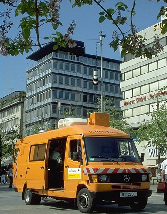 |
Fig. 4/3: Mobile measuring system for air pollutants and meteorological variables
.
| | |
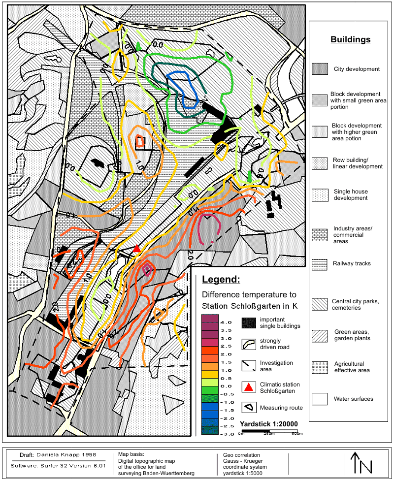 |
| Fig. 4/4: Distribution of air temperatures in the vicinity of central-city parks in Stuttgart, obtained from measurements taken while driving; KNAPP, 1998 |
|


